


وصف لـ Planit: Photo Planner
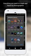
In this free app, the Ephemeris feature is provided as in-app purchase which will be the same as the PlanIt! Pro after the purchase. Some screenshots listed here have Ephemeris features enabled. The free version with the Ephemeris features can actually do a lot of things than you thought. It is a plan/marker file reader, a focal length estimator on the map, a DOF calculator, a panorama calculator, a map with marker features. The Ephemeris features are all inter-connected so it is hard for us to provide some ephemeris features in the free version and ask you to pay for the rest. Although we didn't provide a trial, please feel free to purchase to try it. We can refund you at any time if you don't like it.
The latest video tutorials are available at
https://www.youtube.com/watch?v=JFpSi1u0-is&list=PLTmlTTxPbBbcn1Fd1NRWTOczTY1RYEug4
===
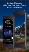
This is a special call to landscape photographers, travel photographers, nature photographers and those who are interested in night photography, city photography, time-lapse, star-trails, milky way or astrophotography: look no more, this is the ultimate app for you - Planit. It only costs you a cup of Frappuccino but will save you tons of time and effort and a lot of gas money. Most importantly, it will make you enjoy landscape photography even more.
Ansel Adams dedicates the beginning of his first book "Taos Pueblo" to visualization. He introduced the idea of "previsualization", which involved the photographer imagining what he wanted his final print to look like before he even took the shot. Of course, there are many great photos which were taken impromptu. However, for landscape photographers, being able to previsualize the scene before going there will greatly reduce the chance of being caught unprepared and will greatly increase the chance of getting better shots.
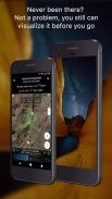
Photographers use various tools to help them pre-visualizing the scene. Nowadays, many of those tools are phone apps. PlanIt! is an all-in-one solution that is designed to leverage the map and simulated viewfinder technologies to provide the necessary tools for photographers to pre-visualize the scene in combination with the ground subjects and the celestial objects such as the Sun, the Moon, Stars, Star-trails and Milky Way.
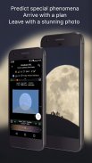
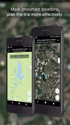
In a single app, we packed it with features - from location scouting such as GPS coordinates, elevations, distance, elevation gain, clear view, focal length, depth of field (DoF), hyperfocal distance and panorama, to the Ephemeris features such as the sunrise, sunset, moonrise, moonset time and direction, twilight time, special hours of the day, sun/moon finder, major stars, constellations, nebulae azimuth and elevation angle, star trail planning, time-lapse calculation and simulation, milky way searching, exposure/ND filter calculator, light meter, bulb timer, rainbow position prediction, tide search etc. All the information are either represented on the map as an overlay or visually presented in a simulated viewfinder (VR, picture, or street view), just like you look through your camera's viewfinder. Whatever you want for your landscape photography, it is there in the Planlt!.
في هذا التطبيق المجاني ، يتم توفير ميزة Ephemeris كعملية شراء داخل التطبيق والتي ستكون مماثلة لبرنامج PlanIt! برو بعد الشراء. تحتوي بعض لقطات الشاشة المدرجة هنا على ميزات Ephemeris ممكنة. يمكن للنسخة المجانية التي تحتوي على ميزات Ephemeris فعل الكثير من الأشياء مما كنت تعتقد. إنه قارئ ملفات مخطط / علامة ، مقدر البعد البؤري على الخريطة ، آلة حاسبة DOF ، آلة حاسبة بانوراما ، خريطة مع ميزات علامة. جميع ميزات Ephemeris متصلة ببعضها البعض ، لذا يصعب علينا توفير بعض ميزات التقويم الفلكي في النسخة المجانية وتطلب منك الدفع مقابل الباقي. رغم أننا لم نوفر تجربة ، فلا تتردد في الشراء لتجربتها. يمكننا استرداد لك في أي وقت إذا كنت لا تحب ذلك.
تتوفر أحدث دروس الفيديو في
https://www.youtube.com/watch؟v=JFpSi1u0-is&list=PLTmlTTxPbBbcn1Fd1NRWTOczTY1RYEug4
===
هذه دعوة خاصة إلى مصوري المناظر الطبيعية ومصوري السفر ومصوري الطبيعة وأولئك المهتمين بالتصوير الليلي أو التصوير الفوتوغرافي للمدينة أو الفاصل الزمني أو مسارات النجوم أو الطريق اللبني أو التصوير الفلكي: لا مزيد من البحث ، هذا هو التطبيق الأمثل لك - الكوكب. لا تكلفك سوى كوبًا من Frappuccino ولكنها ستوفر لك الكثير من الوقت والجهد والكثير من أموال الغاز. الأهم من ذلك ، سوف تجعلك تستمتع بتصوير المناظر الطبيعية أكثر.
أنسل آدمز يكرس بداية كتابه الأول "تاوس بويبلو" للتصور. قدم فكرة "التصويب" ، والتي شملت المصور تخيل ما يريد أن تبدو عليه طبعته النهائية قبل أن يأخذ اللقطة. بالطبع ، هناك العديد من الصور الرائعة التي تم التقاطها مرتجلة. ومع ذلك ، بالنسبة لمصوري المناظر الطبيعية ، فإن القدرة على تحجيم المشهد قبل الذهاب إلى هناك سيقلل إلى حد كبير من فرصة الانخراط في غير الاستعداد وسيزيد بشكل كبير من فرصة الحصول على لقطات أفضل.
يستخدم المصورون أدوات مختلفة لمساعدتهم على تصور المشهد مسبقًا. في الوقت الحاضر ، العديد من هذه الأدوات هي تطبيقات الهاتف. PLANIT! هو حل الكل في واحد تم تصميمه للاستفادة من خريطة وتقنيات عدسة الكاميرا المحاكية لتوفير الأدوات اللازمة للمصورين لتصور المشهد مسبقا بالاشتراك مع الموضوعات الأرضية والأجرام السماوية مثل الشمس والقمر ، النجوم ، مسارات النجوم ودرب التبانة.
في تطبيق واحد ، قمنا بتزويده بميزات - بدءًا من استكشاف الموقع مثل إحداثيات GPS والارتفاعات والمسافة واكتساب الارتفاع ومنظر واضح وطول بؤري وعمق الحقل (DoF) والمسافة الفائقة البؤرة والبانوراما ، إلى ميزات Ephemeris شروق الشمس ، وغروبها ، وشروقها ، ووقت moonset والاتجاه ، وقت الشفق ، ساعات خاصة من اليوم ، مكتشف الشمس / القمر ، النجوم الكبرى ، الأبراج ، سمت زاوية السدم وزاوية الارتفاع ، والتخطيط درب النجوم ، وحساب الوقت الفاصل والمحاكاة ، درب التبانة البحث ، حاسبة تصفية مرشح التعرض / ND ، عداد الإضاءة ، مؤقت المصابيح ، التنبؤ بموقف قوس قزح ، البحث عن المد والجزر ، إلخ. يتم تمثيل جميع المعلومات على الخريطة كتراكب أو يتم عرضها بصريًا في عدسة الكاميرا المحاكاة (VR ، صورة ، أو عرض شارع) ، تمامًا مثلما تنظر من خلال عدسة الكاميرا الخاصة بك. كل ما تريد لتصوير المناظر الطبيعية الخاصة بك ، هناك في Planlt !.
Planit: Photo Planner - إصدار 10.5.1
(20-02-2024)
Planit: Photo Planner - معلومات APK
نُسخة APK: 10.5.1الحزمة: com.yingwen.photographertoolsتطبيقات من الفئة نفسها
قد يعجبك أيضًا...


